
The UK faces a major change in weather as a 600-mile rainstorm is set to sweep across the nation at the end of August 2025. For weeks, Brits have enjoyed record heat, but forecasts from the Met Office and other meteorologists confirm that the coming storm will bring widespread rain and falling temperatures. The situation has made headlines, sparking trending searches and concerns about travel, flooding, and public safety.
Dramatic Transition from Heatwave to Rainstorm
This summer, the UK experienced its fourth heatwave. Temperatures climbed past 30°C in many regions, prompting yellow warnings for heat stress and prompting health officials to advise vulnerable groups to take extra care. The sunshine and dry conditions were a marked contrast to earlier periods of unpredictable weather, with some places seeing historic lows in rainfall for the month of August.
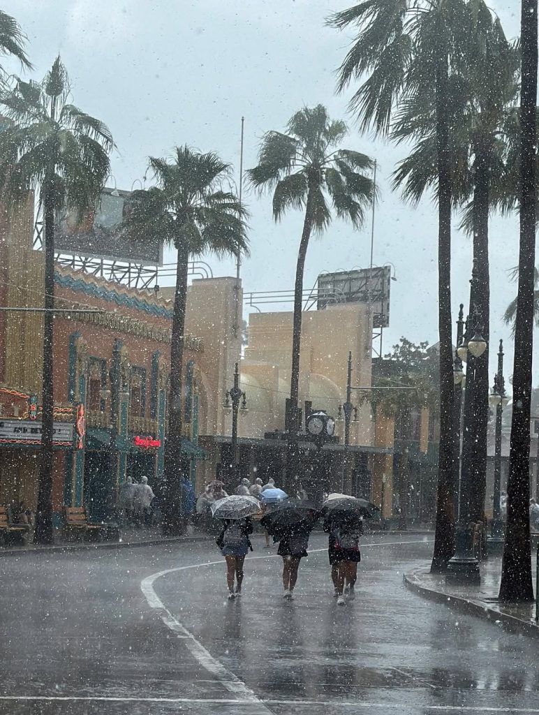
Meteorologists now predict a “wall” of rain stretching 600 miles from southern Scotland down through the East Midlands, starting on 27 August. All but eight counties are set for lengthy, heavy downpours, shifting the outlook from hot, dry spells to chilly, wet weather. Affected regions include southern Scotland and most of England, with Somerset, Kent, Essex, Suffolk, Norfolk, Cambridgeshire, Middlesex, and the Deens set to escape the worst of the rainfall. Current models expect the rain to persist for about 24 hours, peaking around 3mm per hour in some locations on 28 August.
What is Causing the Rainstorm?
The UK’s extreme weather is driven by pronounced Atlantic low-pressure systems and a “zonal” jet stream pattern. Meteorologists explain that these conditions funnel rain-bearing fronts across the British Isles. This setup favours the development of long, persistent bands of rain, capable of impacting vast areas in a short window.
Recent bouts of dry weather, especially in the southeast, stand in contrast to the anticipated storm. Just days ago, less than 1mm of rain fell across much of England, and average monthly rainfall for August was hovering at only 14% of the long-term average. River flows dropped at over 75% of gauged sites, with drought conditions intensifying in the south.
Experts from the UK Centre for Ecology & Hydrology state that while July and early August were notably dry, the shift to wetter-than-normal conditions for late summer and early autumn is increasingly likely. Forecasts warn that despite short-lived dry spells, much of the UK will see above-normal rainfall between August and October, with river flows and groundwater levels set to recover somewhat following weeks of drought in southern and central England.
Met Office Warnings and Regional Impact
The Met Office has issued yellow thunderstorm alerts for parts of northeastern Scotland and eastern Northern Ireland. These warnings highlight risks to travel, power supplies, and public safety, with potential for localised flooding and disruption to train and bus services. The severe weather warnings coincide with projections for heavier and longer-lasting rainfall, particularly in northern and western regions.
Gusts from Storm Floris earlier in August reached as high as 85mph along exposed Scottish coasts, with widespread rain and wind across northern England and Wales. While upcoming storms are not expected to be as severe, authorities urge caution on the roads and railways due to difficult driving conditions, possible power disruptions, and a heightened flood risk.
Community and Infrastructure Concerns
Councils and emergency services across the UK are preparing for the rainstorm’s challenges. Local authorities have prioritised flood prevention, checking defences along major rivers and low-lying urban areas. Rural communities, especially in southern Scotland and the Midlands, were advised to clear drains and report blockages, as surface water flooding remains a risk.
Public transport providers have warned of possible delays or cancellations. Network Rail stated that services in areas with yellow severe weather warnings may be “substantially affected,” with advice issued for passengers to monitor forecasts and check for travel updates. Drivers are encouraged to slow down, leave larger gaps between vehicles, and allow extra time for journeys during heavy rain or low visibility.
Health and Wellbeing Advice
The transition from extreme temperatures to cooler, wetter conditions poses health risks beyond flooding. The UK Health Security Agency has urged vulnerable populations, especially older adults and those with underlying health conditions, to take precautions. The abrupt temperature drop could lead to increased health problems for those not adequately prepared.
Experts recommend keeping up to date with NHS and Met Office advisories and ensuring homes are well-protected against sudden cold snaps or damp conditions. Local GPs and public health officials stress the importance of caring for neighbours and vulnerable family members during periods of unstable weather.
Looking Forward: Forecasts into September
Long-range Met Office forecasts suggest that after the rainstorm, the unsettled weather will continue until mid-September. Meteorologists warn of further periods of heavy rainfall, thunderstorms and gusty winds, especially in southern and western regions. At the same time, temperatures may intermittently climb above seasonal averages in the south, but most areas will experience cooler, damp spells typical of the UK’s unpredictable late summer.
Conclusion
The UK’s 600-mile rainstorm marks a sharp departure from the recent heatwaves and dry spells experienced nationwide. With millions expected to be affected by the incoming weather, officials continue to prioritise safety, preparedness, and timely information. Residents are encouraged to stay weather-aware, heed warnings, and take the necessary steps to protect their homes, health, and travel plans.
As Britain adapts to the shifting climate, the coming weeks will serve as a reminder of the country’s remarkable weather variability. The rainstorm’s effects—and the nation’s resilience—will be topics of discussion long after the clouds have cleared.
Read more: man u