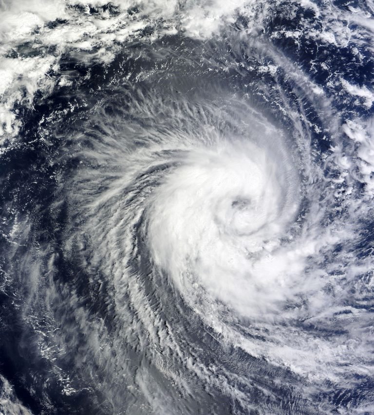
Tropical Storm Erin is rapidly becoming one of the most discussed topics in weather circles this August. As the fifth named system of the Atlantic hurricane season, Erin is making headlines in the UK with forecasters predicting it may become the year’s first major hurricane. Let’s explore its development, what experts are saying, and how this storm relates to current UK concerns about global weather patterns.
An Early Bloom in the Atlantic
Erin formed on Monday, 11 August, off the coast of Africa near the Cabo Verde islands. The system started as a cluster of thunderstorms, quickly gathering strength due to favourable conditions like warm ocean water and minimal wind shear. Such features allow tropical storms to intensify, a scenario meteorologists have been watching closely this year.
Currently, Erin is speeding westward over the Atlantic at 20 to 23mph, with maximum sustained winds already reaching 45mph. Forecasts suggest that by late Thursday or early Friday, Erin could strengthen into the first hurricane of the season, and potentially into a Category 3 major hurricane by the weekend.
According to the National Hurricane Center (NHC), sea surface temperatures in the Atlantic—one of the key drivers of hurricane strength—remain unusually high, though not quite at the record-breaking levels observed in recent years. Experts believe these conditions are connected to broader climate changes influenced by fossil fuel emission.
Forecast Models and Path Uncertainty
One challenge confronting meteorologists is uncertainty regarding Erin’s ultimate path. Analysis from notable sources indicates that while some forecasting models show the storm may approach areas like North and South Carolina, others suggest it could veer northward, staying offshore. Chad Merrill, an AccuWeather meteorologist, highlights that “the upper air pattern late in the week is conducive to a northward turn, likely keeping Erin off the U.S. coast”. However, rough surf and rip currents could still affect coastal beaches over the weekend.
The National Oceanic and Atmospheric Administration (NOAA) continues to emphasise preparedness despite the current lack of coastal warnings. “This outlook is a call to action: be prepared. Take proactive steps now to make a plan and gather supplies to ensure you’re ready before a storm threatens,” said NOAA’s National Weather Service Director, Ken Graham.
For now, watches and warnings remain limited, but interests in the Caribbean, Bermuda, and along the U.S. East Coast are advised to monitor updates closely.

UK Relevance: Watching Global Weather Trends
Major hurricanes in the Atlantic do not typically reach the British Isles directly. However, remnants of these systems sometimes cross the ocean, impacting weather patterns here—bringing heavy rains, increased winds, and influencing jet stream behaviour. The Met Office regularly monitors such developments, providing updates when Atlantic disturbances could affect the UK’s own weather cycles.
Beyond direct impacts, the UK remains closely involved with hurricane research and humanitarian response. British meteorologists contribute to global forecasting models, and UK charities often mobilise to help Caribbean communities affected by storms. The development of major hurricanes like Erin serves as a pertinent reminder of our interconnected world—where extreme weather events in one region can have ripple effects across the globe.
Climate Change and Increasing Activity
The 2025 hurricane season has been forecast to be busier than average, with NOAA predicting between 13 and 19 named storms. Of these, six to ten could become hurricanes, and three to five may reach Category 3 or higher. Erin is already ahead of the average schedule, as the first major hurricane usually appears in early September.
Meteorologists caution that warming seas and shifting atmospheric patterns are creating conditions ripe for more intense storms. As the Atlantic summer heats up, the window for hurricane formation broadens—a trend the world will be watching.
Recent years have seen devastating impacts from hurricanes in the Caribbean and U.S., from deadly flooding to disruptions in supply chains. Experts reiterate the importance of preparedness and resilience, encouraging communities worldwide to adapt for increasingly dynamic weather scenarios.
Latest Insights from Meteorologists
Experts remain vigilant regarding Erin’s progress. AccuWeather hurricane specialist Alex DaSilva expects further strengthening soon, stating, “Erin is on track to become both the first hurricane and the first major hurricane of the season,” with the system likely to be north of Puerto Rico by the weekend. Matt Devitt, another meteorologist, notes that shifting models suggest most likely outcomes keep Erin offshore but warns that margins of safety can change quickly.
As the storm approaches peak intensity, international agencies will continue tracking its progress and updating advisories. For the UK, this news underscores the importance of global storm monitoring and cooperative meteorological efforts.
The Human and Environmental Impact
Tropical systems can cause more than headline-making winds. Erin’s development brought heavy rains to the Cabo Verde Islands just days ago, leading to flash flooding and fatalities. Such scenes are reminders of the real-world toll severe weather can exert on communities in vulnerable regions.
Ports, supply chains, and vital infrastructure are often disrupted by hurricanes in hurricane-prone areas. While the UK is not in the direct path, consequences can sometimes extend to us through shortages, transport delays, or global economic shifts.
Looking Ahead: Eyes on Erin, Prepared for Change
Tropical Storm Erin’s rapid intensification is a significant meteorological event for 2025. As the system advances over the Atlantic, experts on both sides of the ocean will be watching its progress. Whether it stays offshore or approaches land, Erin serves as a timely reminder for communities everywhere of the unpredictability and power of tropical weather.
In the UK, we continue to watch these global weather patterns, studying their implications and supporting those affected. Meteorologists, policymakers, and the public alike understand that the changing climate means readiness is essential—not only this week but long into the future.
Read more: cristiano ronaldo


